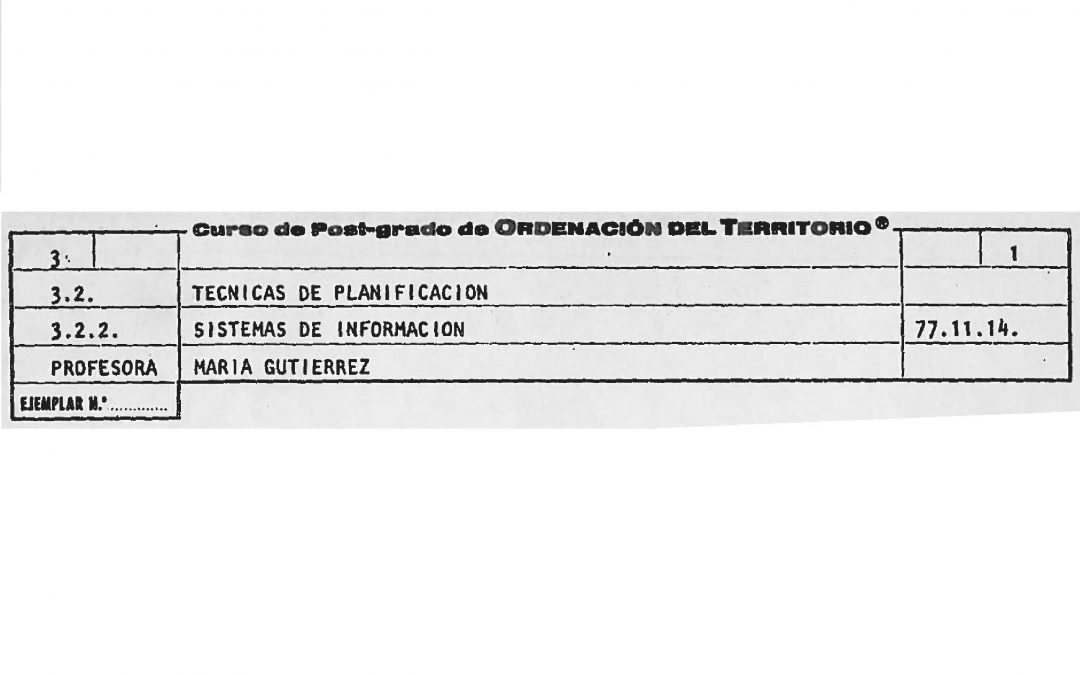
I remember the documentation of a postgraduate course on Planning Techniques where the topic of the day was Information Systems. A course taught by Maruja Gutiérrez-Díaz in 1977. (Maruja is nowadays an innovation consultant after many years working for the European Commission and 15 years in charge of the Regional Information Center in Madrid, which was a pioneering center in digital documentation already in 1973).
In this document (if somebody is interested I can upload it) Maruja establishes some principles:
- Urban planning is a continuous activity: it is subject to permanent changes. However, its lack of efficiency is usual because it can be in contact with a situation at a given time and immediately afterwards it gives it up generally to discover in the next contact that all forecasts made have become unrealistic. Therefore, the continuity of urban planning is a radical and imperative change.
- Urban planning is an integrated activity: from being a theoretical exercise it has to become to be integrated in a complex territorial management system. Maruja establishes administrative processes as regular information sources and also the need for its automation.
- Urban planning is a redistribution mechanism of great social importance in which public participation is essential.
Maruja conceives urban planning as a control mechanism which constantly receives information from the actual information of the system and from the desirable situation of the system, always trying to adjust one to the other, defining the adequate courses of action in the form of plans and projects.
It is incredible that at that time problems where already so well defined. Over 35 years have passed and we still cannot say that digital urban planning is a reality. If with the technological means available in 1977 the ambition was the one demonstrated by Maruja, with the current technological means we have to say that our ambition is quite diluted.
Let’s state some problems and its possible existing solutions:
Technological problems:
- There are no technological problems: all the objective requisites to have completely digital urban planning can be achieved efficiently by the current technology.
- There is only one condition: the continuous urban planning that Maruja defended in 1977 requires the contemplation of maps as instruments that are at the service of the spatial planning. Plans are not the spatial planning; they are vehicles which serve the spatial planning. What happens is that the spatial planning built with plans on paper is unmanageable. However, if the instruments are digital and are built like transactions which update the spatial planning; then, it is feasible to obtain a digital spatial planning in force from the review of all the approved instruments.
- And as corollary, if plans must be built as transactions, they cannot be pdf documents or sets of files of a different nature, more or less integrated. Plans must be xml and gml electronically signed documents. In addition, they must contain structured data capable of fitting into an information system.
Urban planning problems:
- The process of urban planning systematization cannot modify the urban planning skill. The skill is always de same, with all its complexities, its advantages and disadvantages. Computer science’s objective is not to simplify plans; its target is to simplify the production and access to the plans, as well as to increase its intrinsic quality. That is why it has to be able to constitute a neutral system which contains the whole spatial planning in force under any legislation.
- It is desirable that the information and structure of plans is subject to a certain degree of “standardization”. This standardization must share standard planning concepts and parameters and must have several spatial plans or urban models also standard. It should favor the implementation of specific solutions necessary to solve the peculiarities of each territory or the oddities of each planner or competent authority.
- It is necessary to separate the information from the mode of representation. Delimitation of sectors is not established by a red dotted line. It is established by a closed polygonal line. According to the form of publication, that line can be represented by red dotted lines or by any other means, as long as its meaning is understandable for the observer.
- It is also necessary to understand that urban planning standardization does not take into consideration the definition of documents and formats of plans. On the contrary, it takes planning concepts and criteria of graphic segregation of the land into account according to the model envisaged for the future.
Legal problems:
- A point of the territory might be affected by local planning, territorial planning, sectoral planning and by legal transitional dispositions. There may be serious contradictions among all of them and there is not any order which establishes which one to follow first; moreover, there is not mutual transposition or mutual updating either. This creates great confusion and moreover the different degrees of graphical accuracy and range of each level make the problem even more complicated.
- The legal commitment of plans lies in the official stamp and in the signature of its documents. It is unclear that digital plans in structured formats can keep their legal commitment. What it is also unclear is that a current spatial plan built by a transactional system can inherit that commitment from the plans which have been used to build it.
Administrative problems:
- Urban planning competency is distributed between the municipality and the Commission for territorial urban planning depending on the region. This supposes that the spatial planning, from a regional point of view is one and from a local point of view, it is another one. In general, the concept of “structural” is used for the regional information and the concept of “detailed” for the local one. Everything, from my point of view, quite artificial and arguable. The spatial planning is the spatial planning; therefore, it is everything which determines the functional purpose of the land. Nevertheless, with these distinctions, confusion is assured.
- To this, we have to add that the spatial planning is also formed by decrees or judgments which emanate from the state level or from the field of jurisprudence and that do not seem feasible to obtain as transactional digital plans. This means that the judgment must be transferred, interpreted and formulated as a digital transaction by a competent technical officer through a process of interpretation susceptible of counteracting its effect.
Production problems:
- Plans are written by technical offices, sometimes by many different offices. That is why I talk about collaborative planning. And these offices have to change the way of making plans, because they must stop using CAD and Word to produce paper and start using specific tools to design transactional digital plans. The experience of Extremadura and Castilla y León testifies to the huge difficulties that the management of this change implies.
- Plans are written by each officer regarding his own planning culture, tinged with the legislation in force. This leads to plans which are heterogeneous, confusing and full of mistakes and which have their own planning concepts, their specific languages of representation and the tactic that “paper can put up with everything”. Nowadays, it is not only necessary to modify the tools used, but also to standardize the product.
We will see in the coming posts some solutions suggested by Arnaiz Consultores